← Profile/Research/IMPAS-Garraf
IMPAS-Garraf
Impacts of submarine groundwater discharge on Mediterranean marine ecosystems: identifying and quantifying contaminant fluxes in the coastal waters of the Garraf Massif.
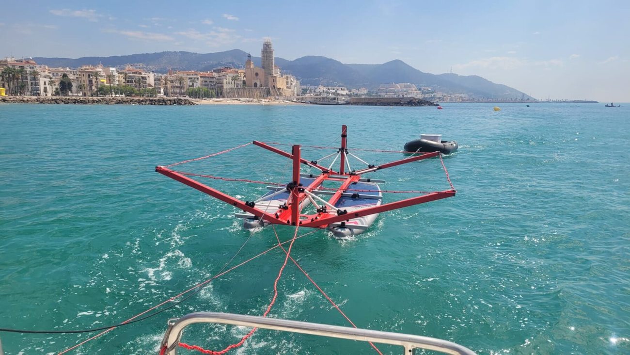
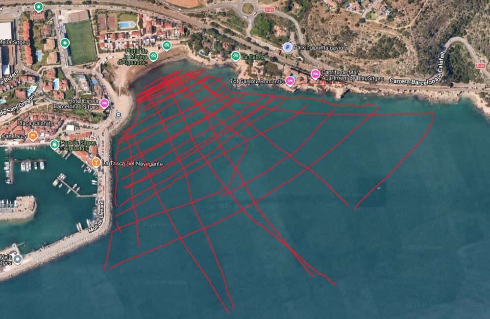
Amphibious electrical resistivity tomography campaign off Sitges · GMAR-UB
Funded by the Catalan Water Agency · RDI001/24/000039 · 2024–2027
Total consortium budget, including own funds and co-funding: €337,479
Coastal waters receive water, nutrients and contaminants not only from rivers but also through submarine groundwater discharge (SGD) — an invisible, diffuse flow that, globally, carries as much solute to the sea as rivers do. In the Garraf Massif, a karst aquifer directly connected to the Mediterranean, the process takes on particular importance: the former Vall d'en Joan landfill, closed since 2006, still releases leachate containing ammonium, mercury, arsenic and other contaminants that seep into the aquifer and, from there, towards the submarine springs along the coast.
IMPAS-Garraf is the first project set up to locate, quantify and monitor these fluxes precisely, and to assess their impact on coastal ecosystems —including Posidonia oceanica meadows— so as to give the Catalan Water Agency knowledge it can apply to coastal management.
Study area
The Garraf karst aquifer (MAS23) and the adjacent coastal water body (C23), between the ports of Vallcarca and Garraf
The Garraf coast
Satellite imagery (Esri World Imagery) · approximate location of the key sites
The seven work packages
Each package names the group leading it. The work led by GMAR-UB —locating the springs and assessing ecological impact— is marked with GMAR-UB
Internal coordination and liaison with the ACA
Consortium management and a two-way information channel with the Catalan Water Agency over the three years of the project.
Characterising the groundwater body
Integrating existing and new hydrogeological, chemical and meteorological data to build the conceptual model of the Garraf aquifer.
Locating the submarine groundwater springs
Multibeam seabed mapping, electrical resistivity tomography and chemical tracers to locate and delimit the discharge zones along the Garraf coast.
Quantifying SGD and compound fluxes
Seasonal campaigns using radium and radon isotopes, a numerical flow model and biogeochemical characterisation of the submarine springs.
Temporal variability of the discharge
Year-long monitoring with instrumented oceanographic moorings and sampling during extreme weather events.
Impact of SGD on the seabed and the benthic ecosystem
Sampling and dating sediment cores to reconstruct the history of contamination and assess its effect on benthic communities and Posidonia oceanica meadows.
Dissemination and outreach
Scientific papers, a public StoryMap, workshops with the ACA and other authorities, and communication to the general public.
The consortium
Five Catalan research groups with complementary perspectives on coastal water bodies
Environmental radioactivity. Leads the project and quantifies SGD using radium and radon isotopes.
Groundwater hydrology. Conceptual and numerical model of the Garraf aquifer.
Electromagnetic and seismic exploration. Resistivity tomography of the aquifer and the landfill.
Marine microbial ecology (CSIC). The microbial dimension of SGD.
GMAR-UB
Marine Geosciences Research Group · leads WP3 and WP6
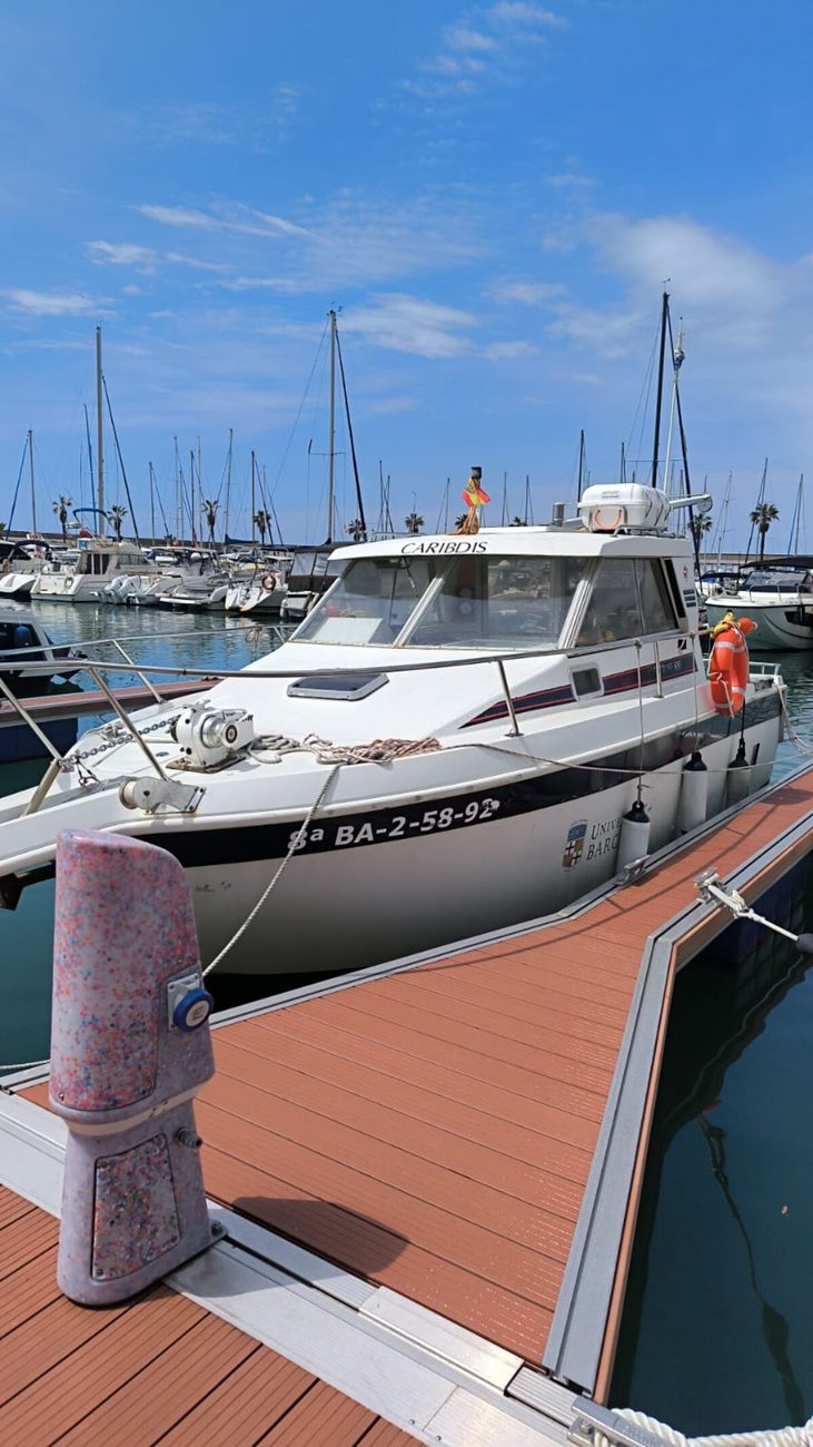
A consolidated research group (2021SGR01195) and an international reference in assessing human impacts on marine environments. It contributes high-resolution seabed mapping —with the UB vessel Caribdis— and the non-destructive sediment-core analysis facilities of the CORELAB laboratory.
- Marc Cerdà i Domènech — principal investigator of the proposal and lead of WP3 and WP6
- David Amblàs Novellas — marine geophysical techniques and morphodynamics
- Anna Sànchez Vidal — ICREA Academia researcher, atmospheric and oceanographic forcing
- Galderic Lastras — seabed mapping and continental margin geological processes
- Jaime Frigola Ferrer — reconstructing oceanographic conditions from sedimentary records
- Laura Moscat — research technician, earlier final-year project on the Garraf springs
Methods
A multi-method approach, pioneering in Europe: tracers, geophysics and models combined to locate and quantify SGD
Multibeam mapping
High-resolution bathymetric echosounders to characterise seabed morphology and reflectivity (GMAR-UB).
Electrical resistivity tomography
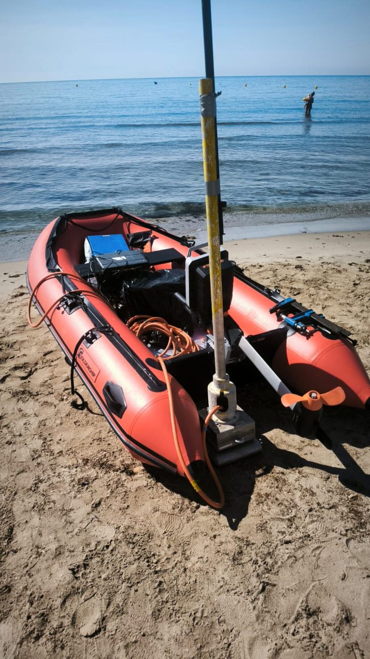
Marine and amphibious resistivity profiles to map preferential discharge zones (GHS-UPC, EXES-UB).
Chemical and radioactive tracers
Radon, radium isotopes, salinity and CO₂/CH₄ for continuous location and quantification of SGD (GRAB-UAB).
Hydrogeological models
Numerical simulation of aquifer flow to predict the magnitude and distribution of SGD (GHS-UPC).
Thermal imaging
Airborne, satellite and drone remote sensing to detect the thermal contrast of SGD (ICGC).
Benthic chambers
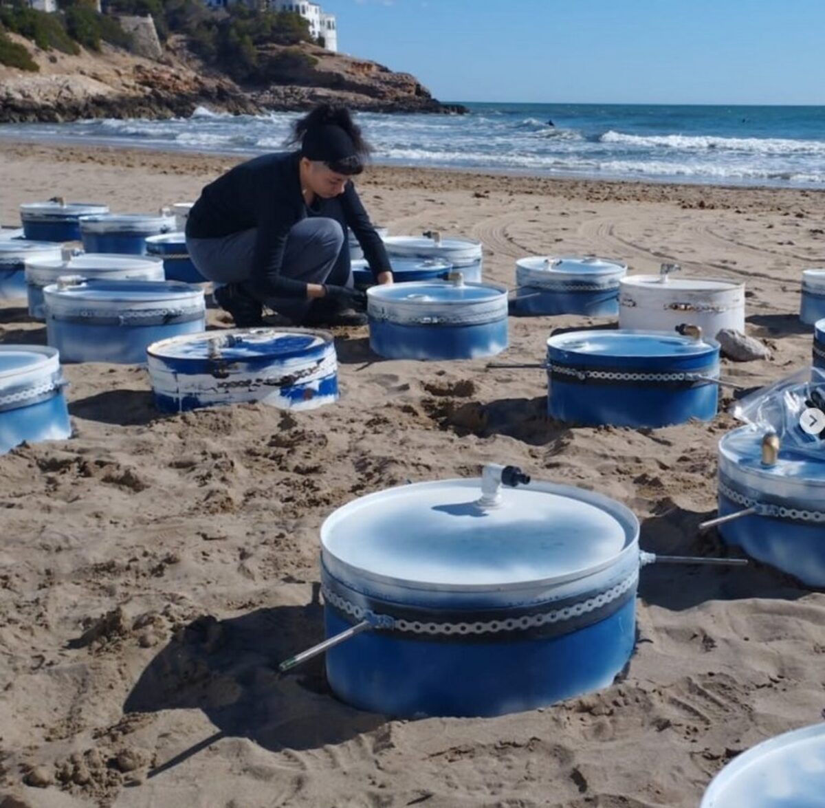
Direct measurement of discharge fluxes at the seabed in the spring areas (GRAB-UAB, GHS-UPC).
Sediment cores
²¹⁰Pb dating and micro-computed tomography (CORELAB-UB) to reconstruct the history of contamination.
Instrumented oceanographic moorings
Conductivity and temperature sensors moored for a year to capture the temporal variability of SGD.
Expected results and benefits
From basic science to the management of the Catalan coast
Scientific
The first regional estimate of SGD fluxes in the Garraf, the first historical reconstruction of their impact on a coastal ecosystem, and new methods —combining tracers, geophysics and machine learning— transferable to other karst aquifers along the Mediterranean coast.
Management
A hydrogeological database for the massif, the first numerical flow model of the aquifer, and executive reports for the ACA as a reference tool for managing and protecting the MAS23 and C23 water bodies.
Social and environmental
Zoning of pollution impact along the coast and key data to protect and restore the Garraf coastal ecosystems, with particular attention to Posidonia oceanica meadows.
In the field
Sampling and geophysical campaigns along the Garraf coast and Sitges
Funding and affiliation